
Tropical Storm Bertha Brings Wind, Rain, and Coastal Flood Threats to Freeport
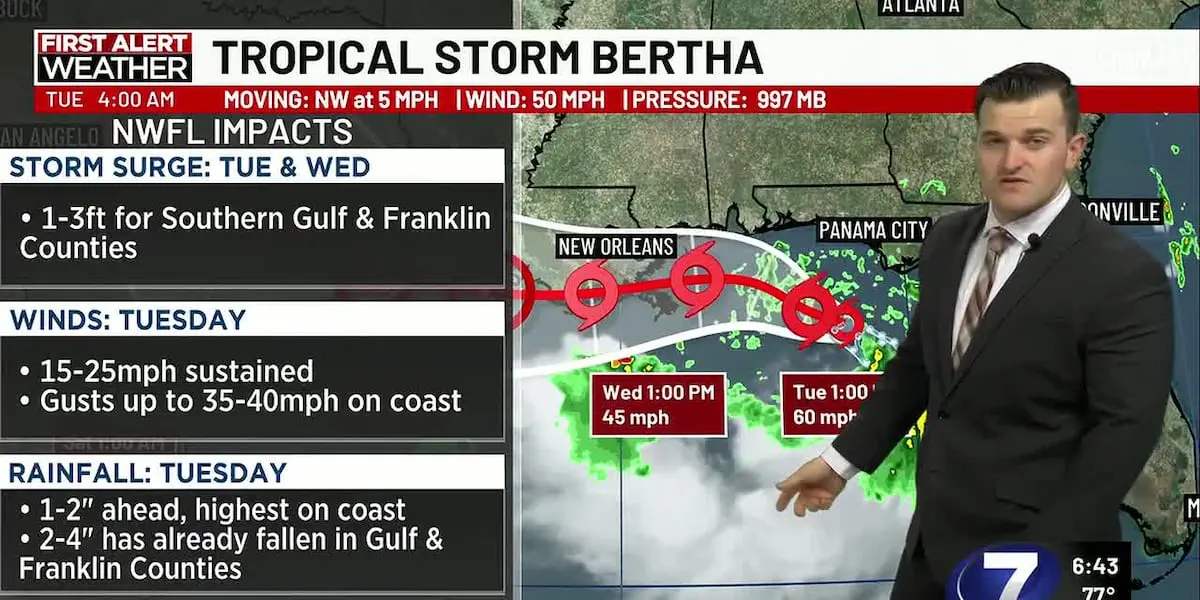
Tropical Storm Bertha formed in the Gulf of Mexico on July 20 and is bringing peripheral impacts to Freeport and the surrounding Panhandle through Wednesday morning, with a Tropical Storm Watch, Coastal Flood Advisory, and High Surf Advisory all in effect for South Walton County.
The National Weather Service in Tallahassee issued a Tropical Storm Watch for South Walton County at 4:48 AM EDT on July 21, naming Freeport, Santa Rosa Beach, and Sandestin as affected locations. As of 4:00 AM, Bertha was packing 50 mph sustained winds with gusts to 40 mph along the coastline, moving northwest at 5 mph. The storm was centered approximately 110 miles south of Panama City, according to the NWS Tropical Cyclone Local Statement. Peak wind forecasts for the Freeport area call for 10-20 mph with gusts to 30 mph, below tropical storm force but enough to produce gusty conditions throughout the day.
A Coastal Flood Advisory and High Surf Advisory are also active for South Walton, Coastal Bay, and Coastal Gulf counties through Wednesday at 2:00 PM EDT. The NWS warns of minor coastal flooding, dangerous rip currents, and large breaking waves of 3 to 11 feet in the surf zone. Residents and visitors should avoid entering the Gulf waters, as breaking waves can sweep people off jetties and docks into dangerous seas. The High Surf Advisory runs from 8:00 AM Tuesday to 5:00 AM Thursday.
WJHG Newschannel 7 meteorologists report that 1 to 2 inches of rainfall are expected across the Panhandle, with up to 2 feet of storm surge along the Emerald Coast. The active weather pattern is holding afternoon highs below average, with temperatures reaching the upper 80s both inland and along the coastline. Showers and thunderstorms will persist throughout the day on Tuesday, clearing out Wednesday night as Bertha moves west. A more typical summery pattern returns by the end of the workweek.
Florida’s state emergency management officials are monitoring the storm but have not activated the state’s Emergency Operations Center, according to Kevin Guthrie, executive director of the Florida Division of Emergency Management. Guthrie said the primary concern is rainfall, with 2 to 6 inches possible depending on where rain bands set up. Five semi-trucks have been staged in Central Florida in case they are needed. Walton County Emergency Management, led by Director Jeff Goldberg, continues monitoring the system and has not requested EOC activation.
This is the same system that prompted a Tropical Storm Watch on July 19 when it was still classified as a tropical depression. Bertha is the second named storm of the 2026 Atlantic hurricane season. Residents should secure loose outdoor items, avoid the surf zone, and stay tuned to official weather channels for updates through Wednesday.
Originally reported by WJHG Newschannel 7, Mid Bay News, and the National Weather Service Tallahassee.
Image: WJHG Newschannel 7
